

Read More: General Motors, Motorq Team Up for In-Vehicle Coaching Service
GM, INRIX Launch New Analytics Tool to Support Safer Roads
A new collaboration between a major automaker and a mobility analytics company aims to help transportation planning organizations achieve their safety goals through connected vehicle data innovation.
August 3, 2022
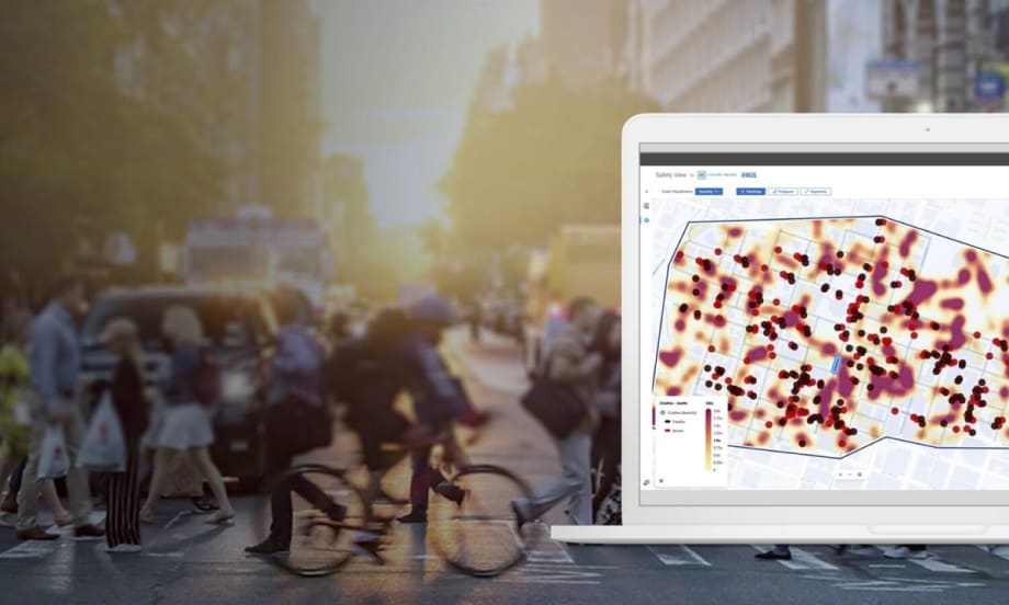
Safety View by GM Future Roads & INRIX is a cloud-based application that provides critical insights using crash and vehicle data to help prioritize and measure the effectiveness of roadway safety projects and their impact on communities.
Photo: INRIX
2 min to read
How many drivers speed on the highway versus the neighborhood roads? How often are crashes linked to a driver failing to stop at a stop sign? On what kinds of roads do drivers most frequently run a red light? These are just a few examples of the kinds of data needed to help transportation planners build safer roads.
Now, there is a new solution from General Motors and INRIX designed to do just that. Safety View by GM Future Roads & INRIX is a cloud-based application that provides transportation officials with critical insights using crash, vehicle, vulnerable road user (VRU), and U.S. Census data, to help prioritize and measure the effectiveness of roadway safety projects and their impact on communities.
With Safety View, transportation professionals can gain access to critical safety and demographic datasets in one cloud-based application. The tool identifies hazardous roadway segments through valuable insights about elements that elevate risk and prioritize those that need the most attention. Finally, Safety View helps professionals evaluate the impact of a Vision Zero action plan with access to near real-time insights through easy-to-use visual analysis tools.
To demonstrate the benefits of Safety View, the partners recently leveraged data analytics from Safety View to assess the road network surrounding 27 Washington, D.C. schools to better understand driving behaviors in school zones. Findings from this sample study highlight the kinds of real-time insights that can be generated using Safety View’s analytics capabilities and datasets, which are customizable by geography.
For example, the data indicated that speeding and the number of crashes didn't vary much between school zone and non-school zone streets — but the severity of crashes was marginally lowered where school zone designations were present. In addition, traffic and school zone signs didn’t appear to have a large effect on slowing down speeding. Finally, speeding was more prevalent in school zones with higher percentages of students on free- or reduced-lunch programs.
While the study offers just one example of how Safety View can benefit planners, the new solution is important as government agencies work to counter the growing number of fatal crashes. Noteworthy, the recent passage of the Bipartisan Infrastructure Law includes $5 billion in discretionary funds as part of the Safe Streets and Roads for All (SS4A) grant program. Safety View can help streamline the funding application process by providing the datasets and analytics tools in one place.
More Safety
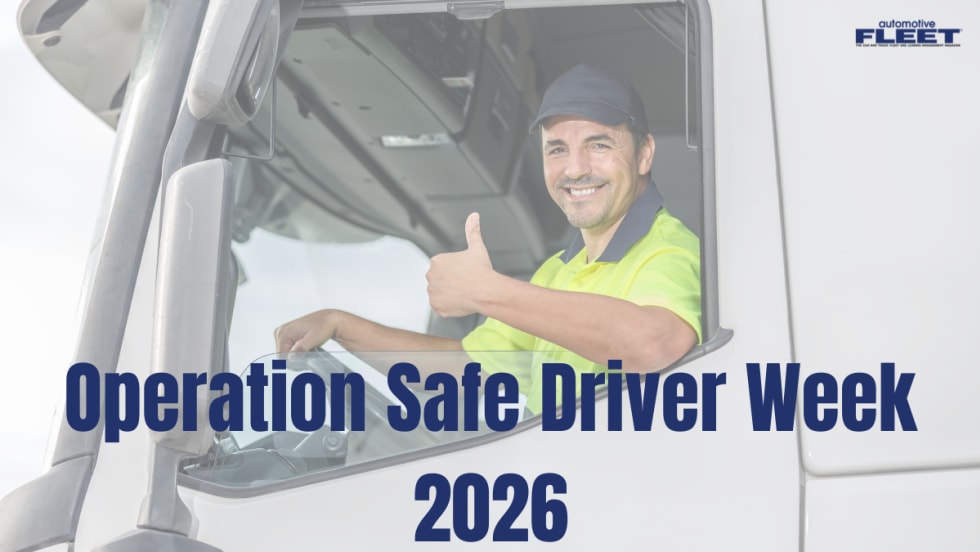
Operation Safe Driver Week: Why the Industry's Oldest Safety Campaign Still Matters to Fleets
A look at how a 2007 enforcement initiative became one of the most consequential weeks on the fleet safety calendar, and what it means for your drivers in 2026.
Read More →
Nexar-Nauto Merger Aims to Give Fleets Better Safety Intelligence Through Larger Driving Dataset
Stefan Heck tells Automotive Fleet that combining more than 10 billion miles of driving history with Nexar's AI models will give fleets deeper insights into driver risk and roadway conditions than either company could provide independently.
Read More →
From Silos to Solutions: Relationship Management for Safer Fleets
From telematics adoption and driver accountability to policy consistency and risk mitigation, this episode breaks down what it really takes to build a safer fleet culture without slowing business down.
Read More →
IIHS Launches First Commercial Vehicle Safety Evaluations
The Insurance Institute for Highway Safety has begun evaluating heavy-duty pickups and cargo vans for driver protection. Which models earned top marks?
Read More →
Reducing Risk by Eliminating Phone Use Behind the Wheel
Hosted with the cofounder of Lifesaver Mobile, this episode addresses phone use behind the wheel and how to design a driving environment that actually helps prevents accidents.
Read More →
Sponsored•July 1, 2026
Cameras, Safety and Insurance: From Reactive Claims to Real-Time Prevention (Part 2 of 2)
Part Two: Commercial auto remains one of the most challenging and costly lines of coverage for fleet operators and insurers alike. Continue learning more about how to effectively address these issues from Onur Aksan, Enterprise Business Development Executive, Geotab
Read More →
How 5-Second Telematics Data Is Changing Fleet Safety
This episode connects with Steve Santostasi of Ford Pro and covers how a few seconds of data can make a difference in fleet safety.
Read More →
Managing Road Risk at Scale: Why Fleet Safety Needs a Data-Driven Framework
Insights from the FIA Road and Driver Safety Indexes reveal how to manage road risk on a larger scale.
Read More →
Stellantis Recalls 1.3 Million Jeep Vehicles Worldwide Over Fire Risk
Stellantis is recalling more than 1.3 million Jeep Wrangler and Gladiator models worldwide over a fire risk linked to power steering pump wiring.
Read More →
Coaching Is Not Training, Even When AI Is Doing It
AI-powered safety platforms can detect risky behaviors and deliver immediate feedback. But effective driver development still requires a foundation of training followed by coaching that reinforces those skills.
Read More →